Publicado el 25 de agosto de 2006:
_
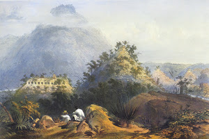
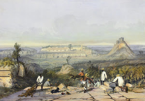
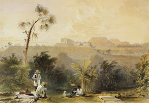
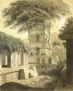
Lámina 8: Panorama general de Las Monjas en Uxmal
__
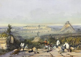
__"Esta imagen muestra las ruinas de Uxmal, un sitio arqueológico antiguo en la cordillera de Puuc en la Península de Yucatán, ciudad prospera y centro religioso Maya desde aproximadamente 800-1000 DC. A diferencia de muchas otras litografías de Catherwood, el enorme cielo abierto y el paisaje que se desvanece detrás de las ruinas nos da una idea de la extensión de la ciudad.
__Uxmal era una ciudad inusual ya que la disposición de sus edificios no concordaba con la topografía natural. Cada estructura fue específicamente alineada en dirección a los cuatro puntos cardinales. La Pirámide del Adivino, que puede apreciarse a la derecha del grabado, es también inusual por su forma elíptica, en lugar de ser rectangular o cuadrada, como eran usualmente las pirámides Maya. En el centro aparece el Cuadrángulo de Las Monjas que se conoce con este nombre por que sus habitaciones en forma de celdas, les recordaron a los exploradores españoles a los conventos. Esta estructura se distingue ya que sus cuatro edificios fueron levantados en niveles diferentes; el edificio del norte es el más alto, seguido por los de oriente y occidente, siendo la estructura de sur la de menor altitud.
_En primer plano se puede apreciar a los residentes locales trabajando frente a la Casa del Gobernador, aparentemente despejando el sitio arqueológico para la exploración de Stephens y Catherwood".
_________________________*_*_*_*_*_*_*
_
General view of Las Monjas of Uxmal (J. C. Bourne)
_
:_"This image depicts the ruins of Uxmal, an ancient site in the Puuc hills of the Yucatán peninsula, which was a thriving city and religious center for the Maya between ca. 800-1000 CE. Unlike many of Catherwood’s other prints, the huge open sky and the land fading away behind the ruins give a sense of the vast size of the city.
__Uxmal was unusual because the plan of its buildings did not literally follow the natural topography. Each structure was set very specifically in alignment with the four cardinal compass points. The Pyramid of the Magician, seen in the right of the print, is also unusual in that it is elliptical, rather than square or rectangular, as is typical of Maya pyramids. At the center, the Nunnery Quadrangle, so called because the cell-like rooms inside reminded the Spanish explorers of convents, is set apart by the fact that its four buildings are placed on different levels; the north building is the highest, followed by the east and west, with the southern structure the lowest in elevation.
_In the foreground, local people are shown working in front of the House of the Governor, presumably clearing the site for Stephens’ and Catherwood’s exploration".





No hay comentarios:
Publicar un comentario